The Dataloy Distance Table is a simple, yet powerful, tool for calculating sailing routes and distances.
Powerful and easy to use tool
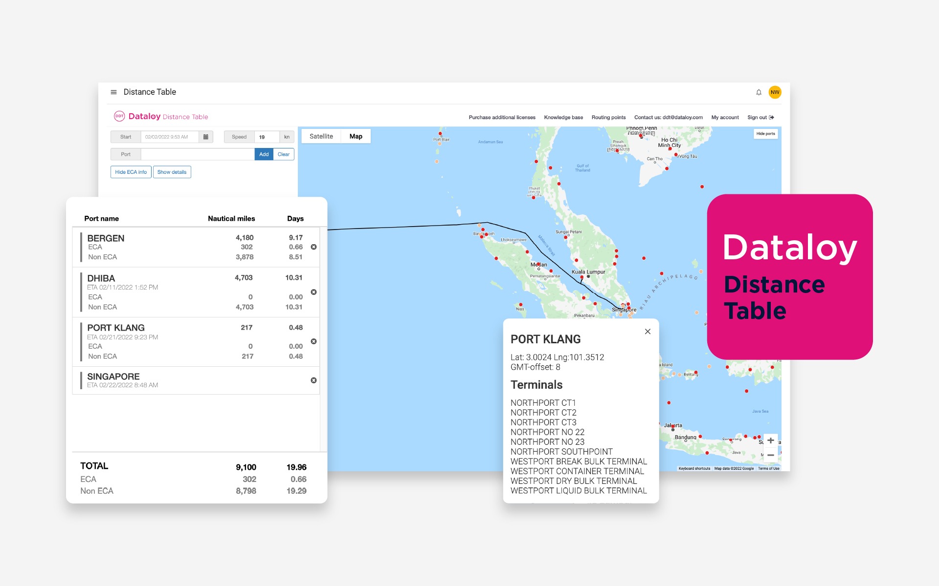
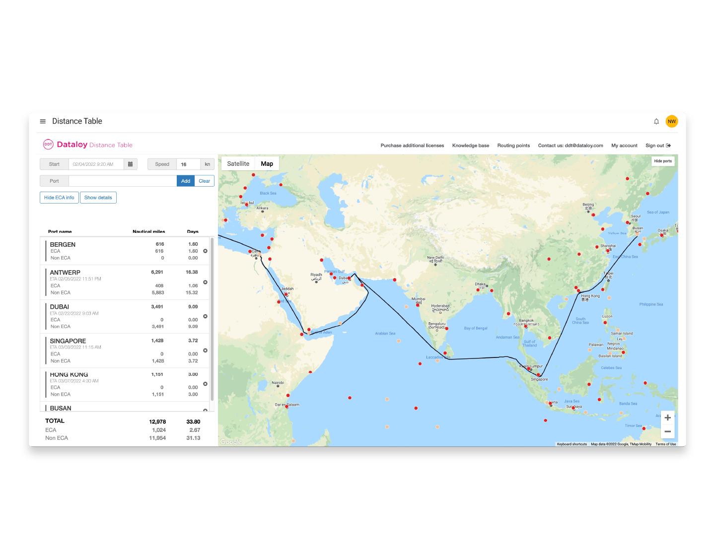
The Dataloy Distance Table Knowledge Base (DDT KB) is the main source of information and answers to queries and issues regarding the DDT. The DDT allows routing point/port name searches when building port rotations by name and map, alternative spellings / shortening of port names as well as usage of each routing point’s unique code. Sailing routes are presented graphically, based on analysis of possible routing options.
Accurate distances between 9500 ports and maritime locations worldwide.
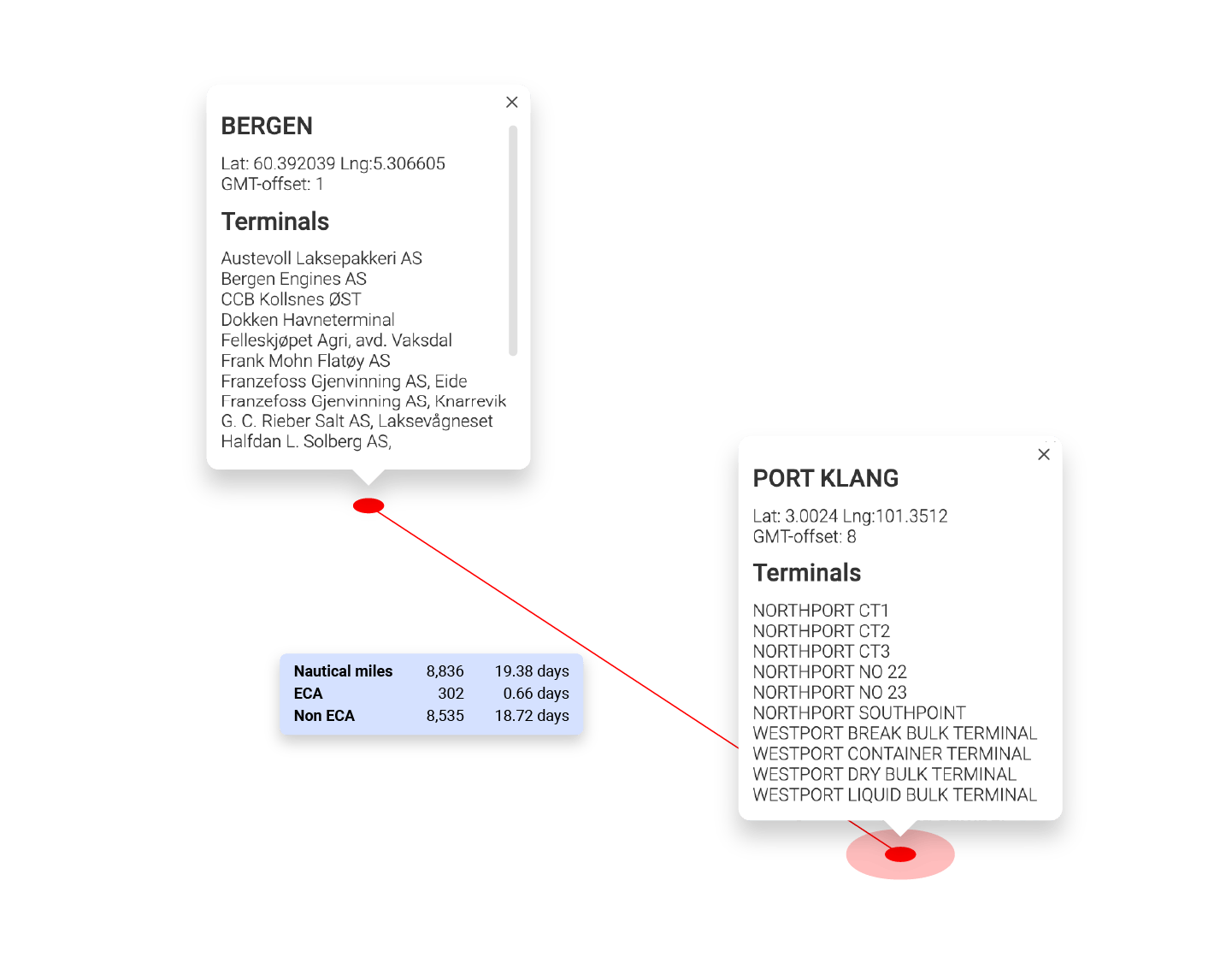
The Dataloy Distance Table is highly acclaimed for its extensiveness and accuracy. The database currently holds more than 9,500 ports and maritime locations, and more than 83,000 waypoints contribute to the accuracy of the calculation. Each port and waypoint is carefully placed based on actual ship traffic and thorough analysis of routing options.
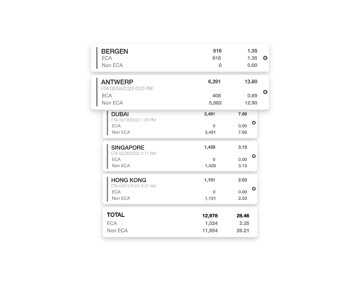
ECA Zones and ECA distance calculations
ECA sailing routes are both visualised and calculated (distance and duration) for each voyage leg.
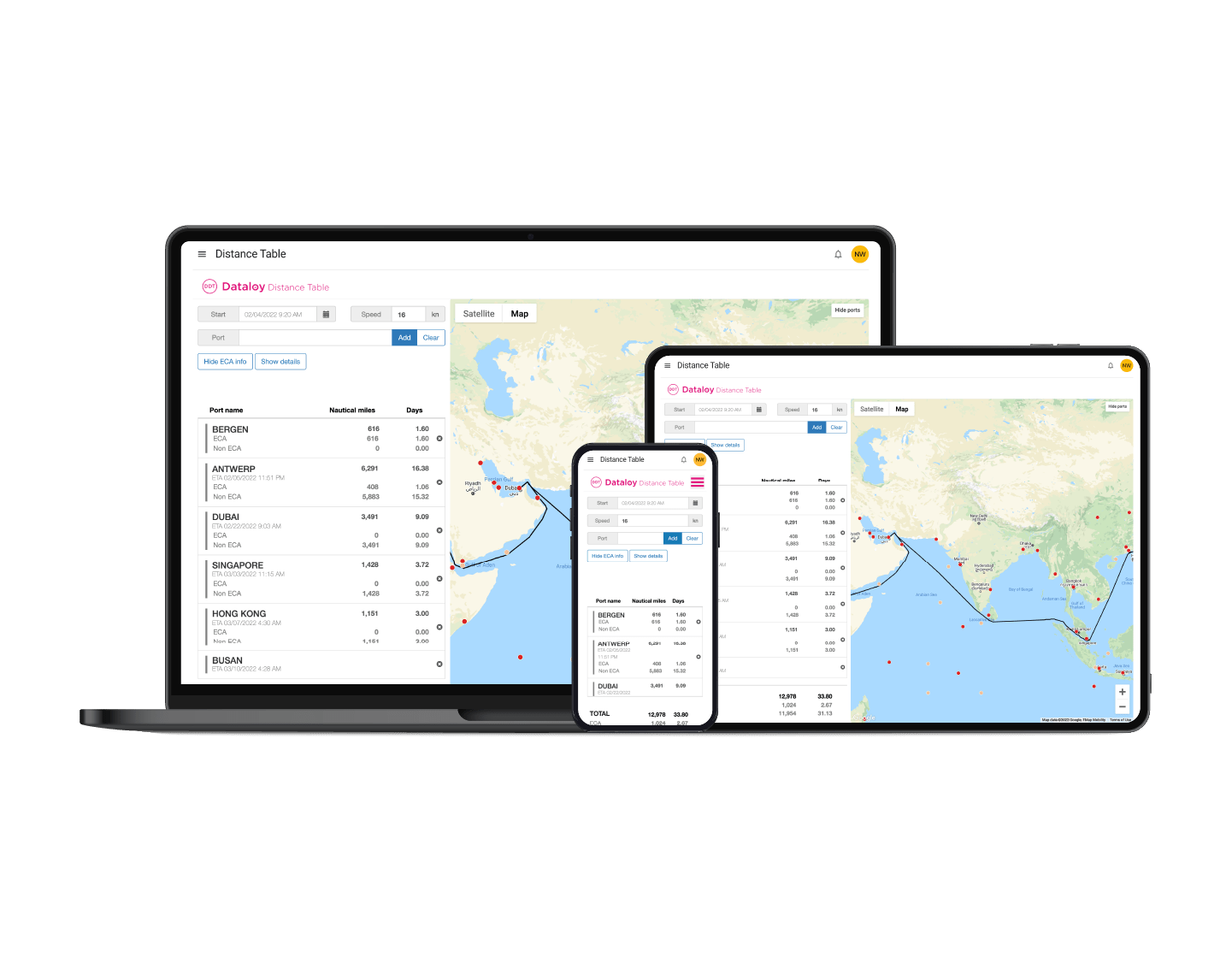
Improved map and route visualisation
The new map and route visualisation gives the users full overview over the sailing route with detailed zooming capabilities and satellite imagery. Identify alternative routing points and re-route your calculation easily.
Dataloy Distance Table is now supported on all your devices
You can work from your desktop, phone and tablet!
Voyage Management System
Dataloy Voyage Management System is VMS is an advanced and comprehensive software for voyage management at all its stages, from planning to post-fixture.
The VMS API is designed to connect Dataloy VMS to the best in breed solutions for the maritime industry, helping you expand your product lines, increase the pace of innovation, and cut costs and time for integration.